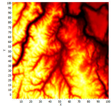
These data come from a 100x100 pixel surface in which each pixel represents the elevation of a 1x1 km area from the northern Cascade Mountains in Washington (data adapted from the U.S. Geological Survey).
The diagram is shaded from black (low elevation) through red and yellow to white (high elevation).